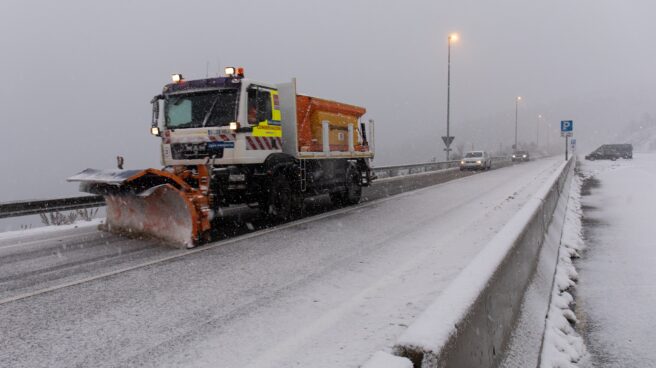

A snowplow removes snow from the roads of Puerto de Navacerrada on November 22, 2021.
The first “full winter episode” of this quarter will arrive this Sunday, January 15, mid-season, after Sunny Friday and Saturday with temperatures that can reach 20 degrees Celsius in Cantabria and the Mediterranean, according to the State Agency. Meteorology (AEMET), which announces a “reversal of trend”, which includes severe cold and snowfall at low levels in the northern half and half a meter thick in mountainous areas over the next week.
AEMET spokesman Rubén del Campo predicted a cold front would arrive late on Saturday and sweep the peninsula from the northwest to the southeast on Sunday, leaving rain in its wake. Although the most intense and persistent will be recorded in the northern third, as they advance, they will lose intensity, but they are not excluded in the center, southern half, northern Catalonia and the Balearic Islands, although they will not reach the Mediterranean Sea. region.
Following the passage of the front, a cold air mass of polar origin will enter, which will contribute to a decrease in temperature and snow level, which will begin at an altitude of about 1000 m in the far north and fall to 500-700 m at the end. Sundays, when the rainfall tends to subside.
“Snow accumulations are expected in all mountain systems of the northern half of the peninsula, especially in the Cantabrian mountains, the North Iberian mountains and the Western Pyrenees. In this episode of winter weather, our mountains, which reach the equator of this winter quarter with very little snow, will see an increase in snow thickness,” he commented.
In particular, it is estimated that from Sunday to next Friday they may add more than 40 or 50 centimeters of new snow at the high levels of the Cantabrian mountain range and the Pyrenees; 15 to 20 centimeters at high altitudes in the Central and Northern Iberian system and 10 to 15 centimeters in the southern mountains of the Iberian system and in the southeastern mountains.
In this scenario, the temperature on Sunday will drop by 6-8 degrees Celsius compared to the previous day, and there will be frost in the mountainous regions, the interior of the center and in the north of the peninsula.
Both Sunday and Monday we will talk about the temperatures typical for this season”
In addition, on Monday, the instability line will leave very heavy rainfall in the northern third of the peninsula, especially in the easternmost part of Cantabria, and the snow level will temporarily rise to 1600-1800 meters. On this day, the wind will intensify, which will blow with a westerly component, with very strong gusts in the northwestern quadrant of the peninsula, as well as in the mountainous regions of the eastern half. Similarly, the state of the sea in the Cantabrian Sea will deteriorate.
Temperatures will drop on Monday and night frosts will recur across large inland areas, with the Mediterranean still reaching 20ºC during the midday hours. “We will talk both on Sunday and Monday about the temperatures typical for this season,” commented Del Campo.
The Representative said it was likely that winter conditions would increase on Tuesday and maritime polar air would rush into the peninsula and the Balearic Islands as strong winds arrived from the northwest with very strong gusts over large areas. This will lead to a further drop in both temperatures and snow levels, which will drop to 700 meters in the northern half. Showers will also be recorded throughout the peninsula and the Balearic Islands, except in the extreme southeast, although the most intense and prolonged rains will be recorded in the northern half of the peninsula on Tuesday.
Colder than normal temperatures
As of Wednesday, AEMET considers it “predictable” that the wind will change direction to a northerly component and favor the penetration of the Arctic mass, so temperatures will be “very cold” and even below normal for that time. Del Campo notes that Wednesday’s decline will be wide-ranging and likely to be noticeable in the northern third on the day the wind turns north.
Snow levels will drop to 500 meters on Wednesday in the center of the peninsula and even Thursday to 200-400 meters in the northeast quadrant, so snowfall is possible in the lower areas of the northern half. In the rest of the country, precipitation will be more scarce and will fall mainly in the highlands in the coming days.
This general thermal decline will also be noticeable in the northern third on Wednesday, when heavy rains will also be recorded in the Cantabrian Sea.
The “real protagonist” of next week will be the cold across almost the entire country with intense and extensive frosts starting as early as Wednesday.
According to an AEMET spokesman, the “real protagonist” next week will be the cold across almost the entire country, with severe and extensive frosts that will pass from Wednesday and could drop temperatures to -4 o -5ºC until Friday in the east of the country. part of two plateaus and even down to -8 or -10ºC in mountainous areas. Frosts will be widespread in the interior of the peninsula during the central hours of the day, and in many provincial capitals, they will barely exceed 5-7ºC, if forecasts come true. On Friday, they will begin to rise, and a more moderate environment will be restored.
For the Canary Islands, an AEMET spokesman predicts “calm winds” on Friday and Saturday, but expects the trade winds to pick up on Sunday, blowing hard and pulling clouds north of the larger islands, leaving more rainfall. and the temperature will drop a little.
Source: El Independiente