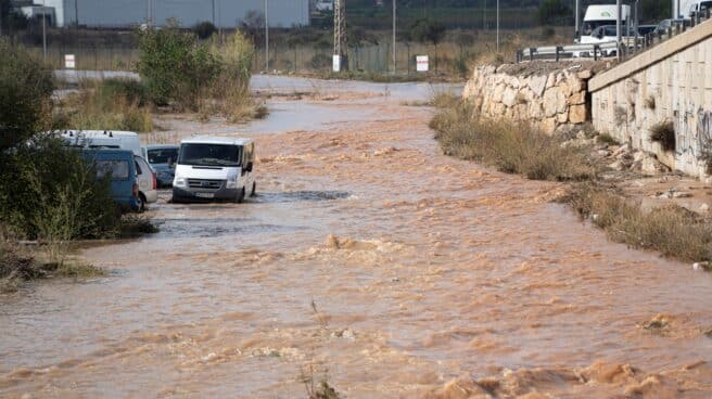

A flooded section of the A-3 eastern highway on November 12, 2022 in Valencia.
Wind and coastal events will put this Tuesday, November 15 at risk (yellow) or significant risk (orange). The northwest of the peninsula and the west of the Central System will also be on high alert due to rain, according to the forecast of the State Meteorological Agency (AEMET).
Specific, Asturias will be at risk due to waves, such as A Coruña, where the alarm is elevated to important.. The wind will also endanger the province, where very strong gusts up to 80 kilometers per hour are expected.
Also in Galicia, Lugo will be at risk from coastal events and winds, as will Pontevedra.where the rain alert is also active. Rain will also put Cáceres, Avila and Salamanca at risk, while Burgos will be at risk due to wind.
Thus, instability is expected to increase due to a new Atlantic front that will cross the peninsula from the northwest to the southeast and will leave behind cloudy or overcast skies and precipitation.
Precipitation will be constant and can be heavy in the western part of Galicia. during the first half of the day, and they may also have a certain constancy in the vicinity of the western Central System and the western Pyrenees.
Also, Precipitation is not expected in the south-east of the peninsula, where medium and high cloud cover will prevail.while in Mallorca and Menorca rain is not ruled out in the early hours, and in the Canary Islands some cloudiness is expected.
Secondly, AEMET has indicated that snow levels in the Pyrenees will be between 2200 and 2400 meters.by the end of the day having descended to 2000 meters.
Same way, possible low clouds and morning fogs in Mallorca, depressions in Huesca and Lleida, coastal areas in the southeast and west of Andalusia, and haze is not ruled out in the Canary Islands.
Regarding temperatures, the maximum will drop slightly over most of the peninsula, although the Mediterranean, Cantabrian and Galicia areas will see few changes or slight upswings. Minimum values will increase in Galicia, the southern half of the peninsula, the Iberian system and the Balearic Islands. In the rest of the thermal changes there will be little.
For its part, the wind will be from the southwest, shifting to the west after the passage of the front on the Atlantic and Cantabrian slopes, while waiting strong intervals on the coasts of Galicia and Cantabria, as well as with very strong gusts of wind in the highlands.
Also, westerly wind expected in the strait and, at strong intervals, in Alboranwhile the southwest will prevail in the Mediterranean area and weak trade winds in the Canary Islands.
Source: El Independiente