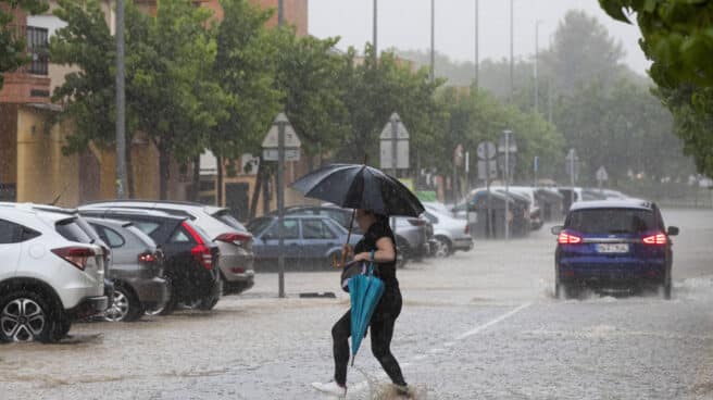

A woman crosses a flooded street after a hail and water storm hit La Alberca, Murcia this Wednesday.
On weekends June 2–4the weather in spain is expected unstable weatherwhich will bring with it heavy clouds, showers and sometimes severe storms in most of the peninsula and the Balearic Islands, according to AEMET.
On Friday 2nd, showers and storms will be more frequent and intense in the afternoon in the center, inland areas in the north and east of the peninsula, as well as in the southwest and in the Balearic Islands. However, in the Ebro valley they will be less likely.
He Saturday 3 and Sunday 4, heavy rainfall in Spain is expected to reappear over large areas of the northern half, mostly in the afternoon, and more dispersed in the southern half of the peninsula. Although daytime temperatures are expected to drop in the southern half on Friday, they are expected to rise slightly over the weekend throughout the peninsula and the Balearic Islands. At some point in the Guadalquivir Valley, it can reach 30 degrees.
As for the winds, they are expected to be weak and variable in the interior of the peninsula, while in the coastal areas and on the Balearic Islands, the wind of the northeast component prevails. In the Canary Islands, due to the approach of the front, the formation of diurnal current clouds with showers on islands with higher relief, more intense and extensive on Sunday, is likely.
Weather in Spain for the week from 5 to 11 June
Instability will be characteristic of the weather at the beginning of the week from 5 to 11 June with heavy clouds, showers and places of severe storms in most of the peninsula and the Balearic Islands. On Tuesday, showers and storms are expected to be less likely and weak in the southern half of the peninsula.
As of Wednesday, the passage of successive frontal systems is expected to leave rainfall over large areas of the peninsula, more intense in the afternoon and sometimes accompanied by storms. However, rain will be less likely in the Ebro Valley, on the coasts of the peninsular Mediterranean, in the Balearic Islands and, starting from the weekend, in the southern third of the peninsula.
For temperature, except for Wednesday’s decline in the southwestern half of the peninsula, they are expected to rise slowly overall. As for the winds, they will be northeasterly in the Bay of Biscay and in the Mediterranean Sea, in the rest – weak and variable, but from Thursday they will tend to acquire western and southern components.
IN Canary IslandsAn Atlantic storm is expected to bring heavy rainfall early in the week, with significant amounts accumulating especially on Tuesday. For the rest of the week, precipitation is likely to continue on islands with more relief relief, not excluding them on the rest of the archipelago. The wind will blow from the southwest, with a transition to the northern component by the end of the week.
Trend for the period from 5 to 25 June 2023
The European Center Forecast Model (VarEPS-Monthly) shows on maps of climatological anomalies over the past 20 years the weekly averages of two meteorological variables: temperature at 2 meters (T 2m) in ºC and Precipitation total (PCP) in mm.
Those areas where the predicted VarEPS-Monthly values do not differ significantly from the model climatological series are shown in white.
Source: El Independiente